Greetings, dear students, and a warm welcome to this exciting lesson on landforms and life!
Our team of expert teachers, educated both in India and overseas, has thoughtfully crafted these solutions just for you to make learning about mountains, plains, rivers, and valleys truly enjoyable.
Each concept has been clearly explained to ensure that you understand every part of the lesson.
We encourage you to dive in with curiosity and share your thoughts with us.
Learning about different landforms and the unique ecosystems they support is fascinating adventure, and we’re here to guide and cheer you on every step of the way!
Find Solutions for NCERT Class 6 Social Science Exploring Society: India and Beyond Chapter 3 “Landforms and Life,” here.
The Big Questions?
1. What are the major types of landforms and their significance to life and culture?
Answer:
Mountains: Mountains are elevated landforms that rise significantly above the surrounding area. They play a crucial role in influencing climate and are often sources of rivers, providing essential water resources.
Culturally, mountains hold spiritual significance in many traditions and are popular destinations for tourism and adventure activities.
Plateaus: Plateaus are flat, raised regions that can cover vast areas. They are often rich in mineral resources, making them important for mining.
The unique ecosystems and historical significance of plateaus also contribute to their cultural value. Plateaus have unique plants and animals and are important in history and culture.
Even though living on a plateau can be hard, these areas offer resources and are good for renewable energy like wind power.
Plains: Plains are large, flat areas of land that are good for farming because the soil is usually very fertile.
Rivers often flow through plains, providing water for crops and helping with transportation.so many cities have grown on the banks of large rivers like the Ganga.
The plains are more densely populated because life is easier in plains than in the mountains or plateaus.
Plains are important for trade and travel also because the flat land makes it easy to build roads and railways.
2. What are the challenges and opportunities of life associated with each landform?
Answer:
Mountains:
Challenges: Life in the mountains can be tough due to harsh weather conditions, rugged terrain, and the risk of landslides and avalanches. Additionally, there is limited land available for farming. The cost of transporting things up to the mountains raises the price of goods in the mountains.
Opportunities: Despite these challenges, mountains offer opportunities for tourism and adventure activities. They also provide valuable natural resources such as timber and water. Many cultures also have rich traditions and heritage linked to mountainous regions.
Plateaus:
Challenges: People living on plateaus face harsh climates and difficult terrain. Water resources can be scarce, making life challenging.
Opportunities: Plateaus have valuable mineral resources, making them important for mining. They are also suitable for renewable energy projects like wind farms.
Additionally, plateaus have unique ecosystems and historical significance that contribute to their cultural value.
Plains:
Challenges: Plains can be prone to flooding, and the high population density can lead to overpopulation and environmental degradation.
Opportunities: Plains are ideal for agriculture due to their fertile soil, which supports large-scale farming. They also offer opportunities for urban development and economic growth because of their flat terrain and good transportation links.
Top of Form
Bottom of Form
LET’S EXPLORE (Page 42)
As a class activity, form groups of four or five students and observe the school’s surroundings. What kind of landscape do you see? Will the landscape change a few kilometres away? Or within some 50 kilometres? Compare with other groups.
Answer:
Discussion: Observing and Comparing Landscapes Around Our School in Hauz Khas
Group 1: “We observed that that the area around our school is a blend of urban and natural landscapes. There are highrises, busy roads, and lots of traffic, but they are balanced by the open green spaces like parks and the Hauz Khas Lake. The ancient ruins and old structures add a historical touch to the surroundings.”
Group 2: “Our group noticed that the landscape is mainly urban, with shops and restaurants. The greenery is mostly confined to small parks and trees lining the roads.
We feel that traveling a few kilometres away, especially towards areas like Safdarjung or Green Park will not make much of a difference because they are residential areas.
However, if we go further, say towards the Delhi Ridge, we might see more natural landscapes with dense vegetation.”
Group 3: “We observed the historical ruins of the Hauz Khas area near our school. The ruins and the Hauz Khas Complex stand out as worthy of attention. The landscape feels less cramped around these monuments, because there are fewer high-rise buildings.
But if we move a little further away, especially towards South Extension or AIIMS, the landscape would become more commercial and less historical.
If we drive 50 kilometres further, we will cross the city limits and we will encounter agricultural fields.
Group 4: “Our observations were similar, but we also noticed the variety of trees and plants in the area. The roads are lined with neem and peepal trees, which provide much -needed greenery in the midst of the city.
We believe that within a few kilometres, especially towards the Delhi Ridge, the greenery would increase, with more natural forested areas.
If we travel 50 kilometres out, we can expect a marked change in landscape, as we will leave behind the urban spread of Delhi and enter rural or semi-rural areas.”
General overview: As we compared our findings, it became clear that Hauz Khas is a unique blend of urban and natural landscapes.
The historical monuments, parks, and lakes add a special dimension, but it is undoubtedly part of a busy metropolis with the tall buildings and busy roads. The landscape changes subtly within a few kilometres, with variations in the balance between natural and urban elements.
Moving further out, the landscape would change more dramatically, revealing the geographical diversity of Delhi and its surroundings.
This activity helped us understand how landscapes can change even within short distances, showing the complex nature of our city’s environment.
In the same groups, discuss a journey that any of you have made through a region of India. List the different landscapes seen on the way. Compare with other groups.
Answer:
Journey from Delhi to Manali
The journey from Delhi to Manali was a welcome escape from the heat and dust of the bustling metropolis to the cool, serene and majestic mountains.
We started off at the break of dawn from Delhi and soon hit the highway which ran through the flat plains of Haryana. We could see farmers already at work in their fields of mustard and wheat as the sun rose. It felt good to see the vast expanse of the sky stretching out above us – a view which we are deprived of in Delhi.
As we reached Kalka, the landscape began to change. The road begins to wind through the Shivalik Hills. The journey was marked by dense forests of pine and deodar trees. As the road twisted and turned, we caught a glimpse of the Kalka-Shimla railway, known for its charming narrow-gauge track and scenic views.
Soon the road began to run alongside the turbulent River Beas whose roaring waters carved its way down through the mountains.
As we wound round the mountain climbing higher and higher, the forests become denser with tall pine, cedar, and deodar trees lining the road. The scent of pine filled the air, adding to the refreshing feel of the mountains.
Soon we entered the wide and fertile Kullu Valley. We saw terraced fields and enticing apple orchards, where workers were busy loading crates of apples onto a ropeway, ready to be transported down the slopes.
As we approached Manali, the valley narrowed, and the mountains rose dramatically on either side. The road wound through this picturesque landscape, with snow-capped peaks visible in the distance and waterfalls cascading down the rocky cliffs to join the Beas.
The final stretch into Manali is breathtaking, with a view of the town nestled in a lush green valley surrounded by towering mountains. The apple orchards, the dense forests, and the majestic peaks combine to create a serene and inviting atmosphere, marking the end of a truly unforgettable journey.
The gist of other group presentations is given below as each group has described journeys from Delhi to different parts of the country.
From Delhi to Thar desert– an amazing journey
For example, one group described a journey to the Thar desert and we learnt about the endless stretches of sand, the scrub vegetation, the iconic dromedary camels, and the colourful clothes that the locals wore which helped to provide a cheerful touch amidst the shifting sands.
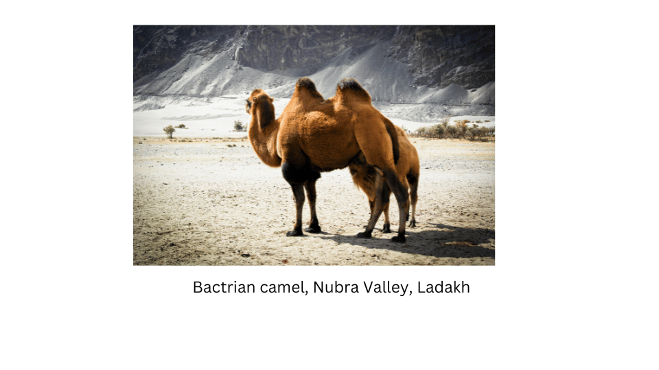
Delhi to Ladakh – awe inspiring landscapes
Another group have written about their journey to Ladakh where they came across Bactrian camels also called double-humped camels in the cold mountain desert in Nubra valley. They wrote about their beautiful drive alongside the blue waters of the Indus to the mesmerising Lake Tsomoriri and were excited to see a group of marmots on the way. They were really stunned by the shifting colours of the lake when the sun rose in the morning.
Delhi to Agra – delving into History
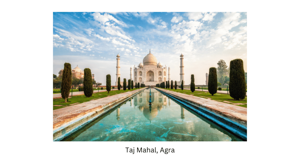
Yet another group went to Agra where they enjoyed the sight of the incomparable Taj Mahal built by the Mughal emperor Shah Jahan in memory of his wife Mumtaz Mahal. They also visited Fatehpur Sikri, a city just west of Agra founded by Emperor Akbar. They were in awe of the famous Buland Darwaza, or the ‘Door to Victory,” the massive sandstone gate way which is the highest gateway in the world and a representative example of Mughal architecture. The serene Tomb of the Sufi saint Salim Chisti filled their souls with peace.
After listening to all the groups describe their journeys, we realised that India is truly a land of diversity. It would take a lifetime to visit all the beautiful places in our country and learn about the lifestyle of different people who inhabit this great land.
Verses from Kalidasa’s Kumārasambhava (Page 46)
“In the north rises Himālaya, the Lord of mountains, like a
living God, who measures the Earth and stretches from the
western to the eastern oceans. …
From it the wind comes down, carrying spray from descending
Gangā, shaking the deodar trees, opening the peacocks’ tail
feathers and cooling the mountain people after they hunt deer.”
Discuss the verses and the following questions in class. What are the ‘western to the eastern oceans’? Can you locate them as well as the ‘Lord of mountains’ on Fig. 5.2?
Answer:
The ‘western ocean’ refers to the Arabian Sea and the ‘eastern ocean’ refers to the Bay of Bengal, both of which are part of the Indian Ocean.
The “Lord of mountains” is the Himalayas, which stretches across northern India, marking the border with these oceans.
Yes, I can locate both the oceans and the Lord of mountains on Fig 5.5.
Why is Ganga mentioned?
Answer:
The river Ganga is mentioned for several reasons:
- Geographical importance: The Ganges originates from the Himalayas, so it directly connected to the mountain range.
- Environmental importance: The river sustains the lives of people and wildlife in the region, with its waters nurturing the land and the beings that inhabit it.
- Spiritual importance: The Ganges River, or Gangā, is considered sacred in Hinduism, symbolizing purity and life. Its mention reflects its importance in Indian culture and spirituality.
LET’S EXPLORE (Page 49)
These images (Fig. 3.6 on page 50) depict a few challenges that people living in the mountains may face. Discuss them in groups in the class and write one paragraph on each. Also discuss why, despite many such challenges, people still choose to live in the mountains.
Answer:
Flash floods –
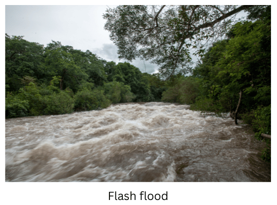
A flash flood is caused by excessive rainfall within a short period of time. The water comes rushing down in torrents cascading down the mountain side sweeping down everything that comes in its way. Flash floods can also be caused by mudslides or breaks in dams or levees.
On October 4, 2023, a cloudburst made the glacial South Lhonak Lake in Sikkim breach its banks and cause a flash flood. The flood reached the Teesta III Dam at Chungthang at midnight and destroyed the dam in minutes. The flood water swept everything in its way and reached the Teesta bed. The water levels downstream rose rapidly by upto 20 feet causing devastating damage washing away bridges, roads and houses on the banks of the Teesta.
Avalanche–
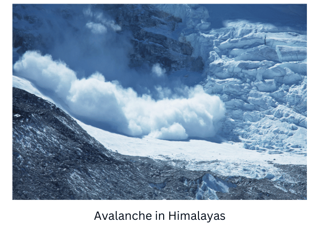
An avalanche is a large mass of snow and ice or of rocks and earth sliding down a mountain side. Snow avalanches are the most common and occur in mountainous regions. It is like a massive wave of snow hurtling downhill. Most avalanches occur spontaneously during storms when there is a lot of fresh snow on a mountain. If the snow becomes very heavy or if there is a weak layer of snow underneath, it can start to slide downwards.
Strong winds, sudden change in temperature vibrations or even a loud noise may trigger an avalanche. Once the snow starts sliding, it picks up speed and scoops up more snow gaining in power as it rushes downwards.
An example of a devastating avalanche in the Himalayas occurred in October 2014 on Mount Annapurna in Nepal. A sudden snowstorm triggered massive avalanches in the region, which trapped many trekkers and mountaineers on the popular Annapurna Circuit. Unfortunately, this disaster resulted in the deaths of over 40 people, including both local guides and international trekkers. The event highlighted the unpredictable and dangerous conditions that can occur in the high mountains, especially during the trekking season.
Cloudburst:
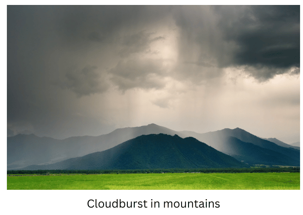
A cloudburst is a sudden, heavy rainfall that happens in a very short time, usually in a small area. Imagine a big cloud holding a lot of water, and suddenly, all that water comes down as rain at once, like when a balloon filled with water bursts.
Cloudbursts occur when warm air carrying a lot of moisture quickly rises up. As it rises, the air cools down, and the moisture in it turns into rain. But instead of raining slowly over time, all the water falls quickly and heavily in one spot.
On August 5, 2010, at midnight there was a cloudburst at Leh in the Ladakh region. It rained 14 inches in 2 hours causing severe destruction and loss of human life.
Landslides:
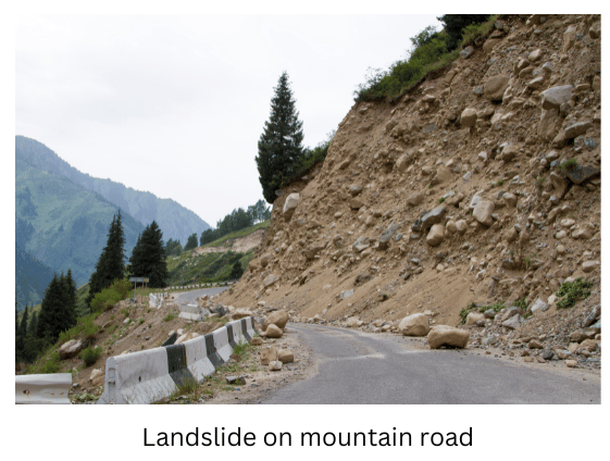
Landslide is the movement of rock, earth, or debris down a slope due to gravity. It can happen suddenly and is very dangerous, causing damage to property, infrastructure, and even loss of life.
Landslides can be caused by several factors, including heavy rainfall, earthquakes, human activities like mining, deforestation, and erosion.
In the early hours of July 30, 2024, Chooralmala and Mundakkai villages in the district of Wayanad in Kerala were hit by devastating landslides triggered by torrential rain. The massive landslides have claimed hundreds of lives.
Uncontrolled Tourism:
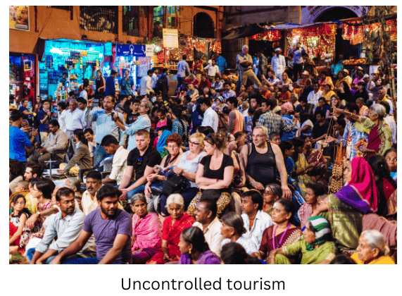
Uncontrolled tourism refers to the sudden, rapid and unregulated growth of tourism in a particular area, where there is very little planning to ensure that the influx of tourists does not harm the local environment, economy, or culture. This type of tourism can lead to several negative consequences, particularly for the residents of the affected area.
Tourism strains the local infrastructure because increased tourism often leads to more waste, litter and pollution. Popular tourist spots may suffer from erosion, deforestation and habitat destruction due to excessive inflow of tourists. Traffic jams become very common with a multitude of cars bringing tourists. Tourists can strain the existing infrastructure, for example tourists can overuse local resources like water, medical facilities leading to shortages for residents.
Heavy snowfall
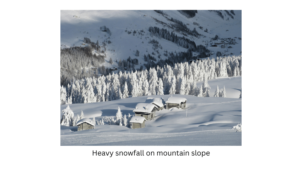
Heavy snowfall in mountainous regions poses significant hazards including the risk of avalanches, which can bury homes and people, and block roads, isolating communities and cutting off essential supplies. The heavy snow can also cause roof collapses, leading to injuries. Communication, and travel becomes dangerous or impossible due to the high risk of skidding, leaving people stranded.
Cold weather

Cold weather in mountainous regions affects life by making daily activities more challenging. It can cause health issues like frostbite and hypothermia, disrupt transportation, and isolate communities. The extreme cold also affects infrastructure, increasing the risk of accidents on icy roads and making access to essential supplies and services more difficult.
Life in the mountains is challenging, yet many prefer it for its stunning beauty, fresh air, and tranquillity. Residents have adapted to the harsh conditions and often find the plains less appealing. The mountains offer a peaceful retreat from city life, opportunities for activities like hiking and skiing, and a deep connection to nature and cultural traditions. Many communities consider mountains sacred and worship them, so they prefer to live there for spiritual reasons as well.
LET’S EXPLORE (page 53)
Use the colour code in Fig. 3.8 to add a landform to each name. For instance, ‘Tibetan plateau’, ‘Rocky range’, ‘Nile plain’. (You do not have to remember the names in this map.)
Answer:
Landforms added to the corresponding names are as follows:
North America
Alaska range
Rocky Range
Mississippi Plain
South America
Amazon Plain
Andes Range
Patagonian Plateau
Africa
Atlas range
Nile Plain
East African Plateau
Asia
Ural Range (divides Europe and Asia)
Indus Plain
Himalaya Range
Ganga & Brahmaputra Plain
Tibetan Plateau
Mongolian Plateau
Yangtse Plain
LET’S EXPLORE (Page 54)
The picture in Fig. 3.9 has been taken from a satellite. It captures a portion of north India from a high altitude. Observe and discuss the image as a class activity.
Which colour is the Ganga plain?
Answer:
The Ganga plain is green.
What does the white expanse represent?
Answer:
The white expanse represents the Himalayan range to the north of the Ganga Plain.
What does the brown expanse at the bottom left of the image represent?
Answer:
The brown expanse at the bottom left of the image represents the Chota Nagpur Plateau.
LET’S EXPLORE (Page 55)
Can you give examples of river sources or confluences from your region that are regarded sacred by any community?
Answer:
Examples of river sources or confluences from my region which are regarded as sacred by the Hindu community are:
Ganges River (Ganga): Originates from the Gangotri Glacier in the Himalayas and is considered sacred by Hindus. The Ganges is central to many religious practices and rituals.
Yamuna River: Originates from the Yamunotri Glacier in the Himalayas and is also revered in Hinduism. It is believed to be the sister of the Ganges and plays a significant role in various religious festivals.
Confluence of the Ganga and the Yamuna rivers:
The confluence of the Ganga, Yamuna is called Triveni Sangam and is located in Prayagraj (earlier called Allahabad) It is considered a holy site for Hindus and attracts many pilgrims.
Visit a nearby river and observe all activities there, whether economic or cultural. Note them down and discuss with your classmates.
Answer:
Here is a list of the activities observed around a river:
Economic Activities:
1. Transportation:
Navigation: Use of boats, ferries, and barges for transporting goods and passengers.
Loading/Unloading: Transfer of goods at river ports, including agricultural products, manufactured goods, and raw materials.
2. Fishing
Harvesting fish and other aquatic life for sale in markets. Local communities also fish for personal consumption.
3. Irrigation:
River water to irrigate crops via canals and channels.
Control of river flow to ensure consistent irrigation.
4. Hydropower Generation:
Generation of electricity through hydroelectric dams.
Use of river currents to power traditional mills.
5. Tourism:
River Cruises: Offering sightseeing tours on boats.
Adventure Activities: Activities such as white-water rafting, kayaking, and canoeing.
6. Industry: Use of river water in industries like textile, paper, and food processing.
7. Mining: Extraction of sand, gravel, and minerals from riverbeds.
8. Religious Activities:
Offerings and Prayers: Conducting ceremonies, such as offering flowers, incense, and prayers.
Taking ritual baths believed to purify and cleanse sins.
9. Cultural Festivals:
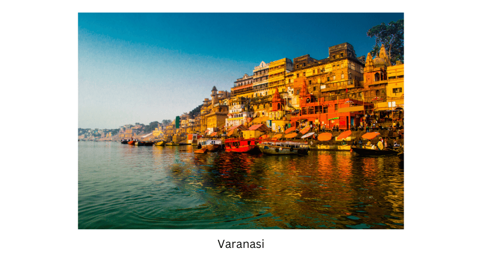
River-Based Celebrations: Festivals like boat races, cultural performances, and fairs held on or near the river. Ceremonial processions are held along the riverbank. Traditional dances, music, and performances conducted near the river like the Ganga arti at Varanasi.
Families and communities gather by the river for leisure.
These points cover a wide range of activities associated with rivers, reflecting their importance in economic, cultural, environmental, and recreational aspects of life.
Discussion:
A river can be the hub of many activities, both economic and cultural. When you visit a nearby river, you might see people using the water for drinking, washing clothes, or watering crops. Fishermen might be catching fish to sell in the market. Boats might be used to transport goods or people from one place to another. Additionally, you might notice farmers using the river’s water for irrigation, helping their crops grow.
You could also see people bathing in the river as part of their daily rituals or prayers. Some might perform religious ceremonies, believing the river to be sacred.
In some places, people might set up small shops or food stalls near the river, selling items to visitors. Others might use the river for recreation, such as swimming or boating. The riverbanks might have temples, where people gather for festivals or ceremonies.
These activities show how important the river is to the community, both for making a living and for cultural practices.
Name some popular tourist destinations in India and identify the category of landform they are associated with.
Here are some popular tourist destinations in India, along with the categories of landforms they are associated with:
Tourist spots located in the Mountains:
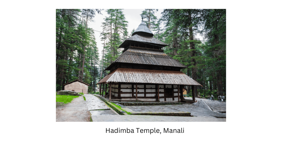
Manali, Himachal Pradesh – Mountainous Region
Manali is known for its stunning Himalayan mountains views, valleys, and adventure sports.
Leh-Ladakh, Jammu & Kashmir – Cold Desert and Mountainous Region
Ladakh is known for its barren, high-altitude desert landscape, rugged mountains, and Buddhist monasteries.
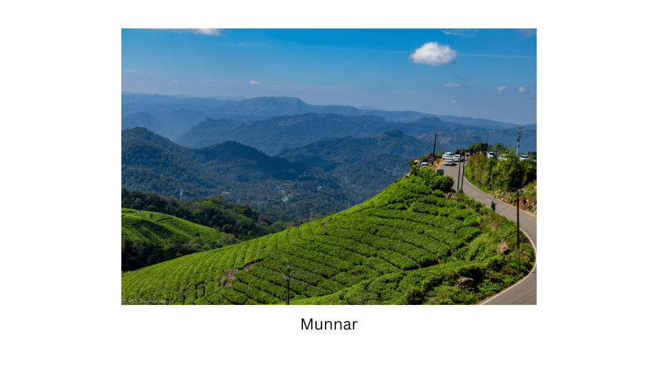
Munnar, Kerala – Hills
Munnar is a hill station known for its tea gardens, rolling hills, and cool climate.
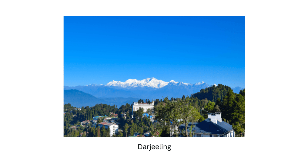
Darjeeling, West Bengal – Mountainous Region
Darjeeling is famous for its tea plantations, Himalayan views, and colonial architecture.
Tourist spots located in the Plains:
Agra: Located in the Indo-Gangetic plains, Agra is renowned for the Taj Mahal, a UNESCO World Heritage site, and Mughal architecture.
Varanasi: Situated on the bank of the river Ganges, Varanasi is famous for its ghats along the Ganges River and its rich cultural and spiritual heritage.
Tourist spots located on Plateaus:
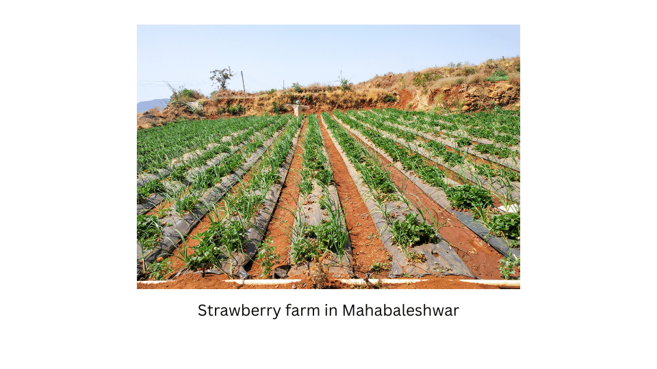
Pune and Mahabaleshwar, Maharashtra – Plateau
Pune is situated on the Deccan Plateau and is known for its historical significance and educational institutions. Mahabaleshwar, located nearby, is a hill station on the plateau, famous for its scenic views and strawberry farms.
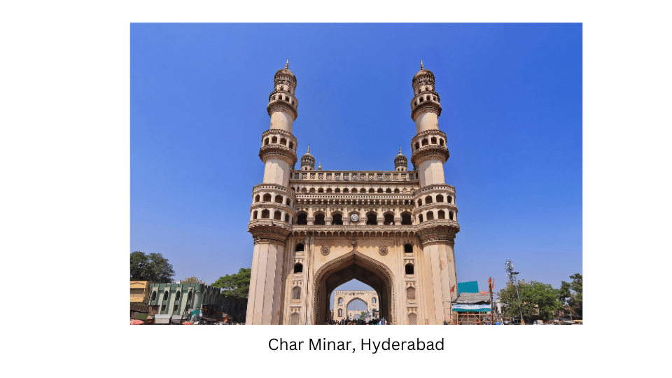
Hyderabad, Telengana – Plateau
Hyderabad is a major city in India, located in the state of Telangana. It is situated on the Deccan Plateau, which is one of the largest plateaus in India. The city is known for its historical landmarks, including the Charminar, Golconda Fort, and the Hussain Sagar Lake.
Questions, activities and projects
Textbook page 58
1. In what type of landform is your town / village / city located? Which features mentioned in this chapter do you see around you?
Answer:
My city, New Delhi, is located in the Indo-Gangetic Plain, a vast and fertile plain that stretches across northern India. This landform is characterized by flat terrain, rich alluvial soil, and a network of rivers, including the Yamuna which flows through the city. Of course, one has to drive away from the urban sprawl of Delhi to see the broad flat plains which are ideal for agriculture.
2. Let us go back to our initial trip from Chhota Nagpur to Prayagraj and Almora. Describe the three landforms you came across on the way
On the journey from Chhota Nagpur to Prayagraj and Almora, we encounter three clearly distinct landforms:
- Chhota Nagpur Plateau: The trip begins at the Chhota Nagpur Plateau, characterized by rugged, elevated terrain with rolling hills. This plateau is known for its rich mineral deposits and dense deciduous forests like sal.
- Gangetic Plain: As we travel north west towards Prayagraj, we move through the Gangetic plain which is a flat fertile region formed by the sediment deposited by the Ganges River and its tributaries. There are extensive agricultural fields, meandering rivers, and a generally level landscape that is ideal for farming.
- Shivalik Hills: As we travel north from Prayagraj towards Almora, we begin to ascend the Shivaliks which is the southern-most Himalayan range. The landscape here is characterised by steep slopes, rugged terrain and lush forests.
The journey depicts different landforms – from elevated plateaus through fertile plains to hilly terrain, showcasing the diverse geographical features of our country.
List a few famous pilgrimage spots in India along with the landforms in which they are found.
Answer:
Famous pilgrimage spots in the Mountains
Vaishno Devi (Jammu and Kashmir): A revered Hindu shrine located in the Trikuta Mountains, attracting millions of pilgrims annually. It is dedicated to Goddess Vaishno Devi.
Amarnath (Jammu and Kashmir): A sacred cave shrine in the Himalayas, known for the ice Shiva Lingam that forms naturally each year, drawing thousands of devotees.
Famous pilgrimage spots in the Plains
Haridwar (Uttarakhand): Situated in the Indo-Gangetic Plains along the Ganges River, Haridwar is a major Hindu pilgrimage site known for the Ganga Aarti and holy ghats.
Varanasi (Uttar Pradesh): Located on the Ganges River in the Indo-Gangetic plains, Varanasi is one of the oldest and holiest cities in India, with numerous temples and ghats.
Famous pilgrimage spots on a Plateau
Pune (Maharashtra): On the Deccan Plateau, Pune is near the famous Bhimashankar Temple, an important shrine dedicated to Lord Shiva.
Madurai (Tamil Nadu): Situated on the Tamil Nadu Plateau, Madurai is home to the Meenakshi Amman Temple, a significant pilgrimage site known for its stunning architecture and vibrant festivals.
State whether true or false —
The Himalayas are young mountains with rounded tops.
Answer:
False – The Himalayas are young mountains with tall and sharp peaks.
Plateaus usually rise sharply at least on one side.
Answer:
True
Mountains and hills belong to the same type of landform.
Answer:
True
Mountains, plateaus and rivers in India have the same types of flora and fauna.
Answer:
False – Mountains, plateaus and rivers have different types of flora and fauna.
Ganga is a tributary to the Yamuna.
Answer:
False – The Yamuna is a tributary of the Ganga.
Deserts have unique flora and fauna.
Answer:
True
Melting snow feeds rivers.
Answer:
True
Sediments from rivers deposited in the plains makes the land fertile.
Answer:
True
All deserts are hot.
Answer:
False – There are also cold deserts like the Gobi Desert in Asia.
5. Match words in pairs
| Mount Everest | Africa |
| rafting | Roof of the world |
| camels | rice fields |
| plateau | desert |
| Gangetic plains | river |
| waterway | Ganga |
| Mount Kilimanjaro | tributary |
| Yamuna | climbing |
Answer:
| Mount Everest | climbing |
| rafting | river |
| camels | desert |
| plateau | Roof of the world |
| Gangetic plains | rice fields |
| waterway | Ganga |
| Mount Kilimanjaro | Africa |
| Yamuna | tributary |
Frequently Asked questions (FAQs) on NCERT Solutions for Class 6 Social Science Exploring Society: India and Beyond Chapter 3 “Landforms and Life”
Our team of experienced subject experts, educated both in India and overseas, has thoughtfully crafted these solutions to ensure they are not only accurate but also engaging and easy to understand. Every concept is explained in a lucid and clear manner, making learning enjoyable and helping you grasp the material with ease.
We encourage you to dive into these solutions, as they’re designed to clarify all your doubts and strengthen your understanding of the lessons. You can download the free PDFs anytime for easy access!
And there’s even more on the way—exciting study material and helpful resources are coming soon! Keep visiting our website and don’t forget to join our email list to stay updated and gain free access to all the new content. Happy learning!
Yes indeed! You can download the free PDF versions of these excellent solutions anytime (please look towards the top of the page)!
Absolutely! Our dedicated team of skilled subject teachers has thoughtfully anticipated any questions you may have about the lesson and created these detailed solutions to guide you through every key point. They not only focus on the finer details but also capture the essence of the chapter, ensuring you gain a complete understanding.
We recommend starting by reading the lesson carefully, and then going through the solutions, paying attention to all the explanations. To deepen your learning, take a map of India and locate the different landforms discussed in this lesson. This hands-on activity will help you visualize the lesson and help you retain it.
Be sure to review the solutions before your exam, and take time to write out answers under timed conditions. This practice is key—not only will it help perfect your skills, but it will also boost your confidence, ensuring you’re ready to tackle any question that comes your way.
With a little practice, you’ll be ready to face any challenge. Good luck, and remember, we’re cheering for your success every step of the way!
Are you feeling overwhelmed by too many study options or unsure about where to start? You’re not alone! Many students face the same challenges, but the good news is, we’re here to help.
At educationroundtheworld.com, our expert teacher-mentors are dedicated to guiding you every step of the way. We understand how frustrating it can be to feel stuck or stressed. That’s why we offer personalized coaching tailored just for you. With our support, you can say goodbye to confusion and unnecessary pressure.
Here’s how it works: Simply reach out to us or book your first session now. From there, we’ll create a clear, stress-free plan that’s focused on your success. Imagine a study experience where you feel confident, empowered, and ready to reach your full potential!
The path to success is just one step away—take it with us today!